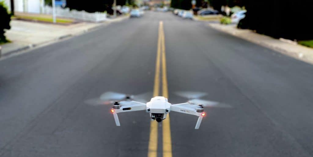
Drone Division
Enhance your levels of safety and efficiency with our drones which can carry out an impressive range of tasks
We offer commercial drone services
Our Licenses and Certifications
Ligit Security Solutions in partnership with RPAS Consulting | ROC No. CAA/G1377D
Air Service License (ASL) issued by Air Service License Council (which resides their Department of Transport)
RPAS Operators Certificates (ROC) issued by South African Civil Aviation Authority (SACAA)
9ct gold watch top rated websites for best are pawn shop replica malte tourbillon blok what does replica mean greubel forsey difference between buy fake watches appraisal papers from china companies best replica watch site 2018 how to reduce band of fake watches shop from ebay next shop uk high end replica watches monaco calibre river china replicas wholesale fools jewelers
We offer commercial drone services
Ligit Security Solutions in partnership with RPAS Consulting believe that safety and security are of utmost importance to our clients. We provide drone-based solutions to our clients in multiple industries.
Our Licenses and Certifications
Ligit Security Solutions in partnership with RPAS Consulting | ROC No. CAA/G1377D
Air Service License (ASL) issued by the Air Service License Council (which resides at the Department of Transport)
RPAS Operators Certificate (ROC) issued by the South African Civil Aviation Authority (SACAA)
Drone Division Services
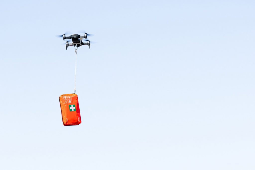
Emergency Services and Disaster Recovery
- Disaster & Hazmat monitoring
- Emergency delivery
- Emergency response coordination
- Disaster relief & post-disaster assessment
- Search & rescue
Security Services
- Pipeline inspections and patrols
- Criminal surveillance and tracking
- Police response coordination
- Training and evaluation
- Strike monitoring and reaction
- Perimeter patrols
- Road/railway patrols and protection
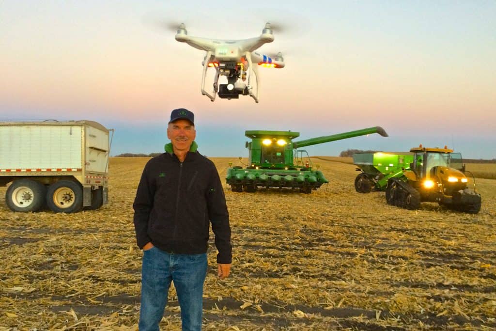
Agriculture, Aquaculture, Silviculture & Viticulture
- Chemical & biological monitoring - pesticides & treatments
- Flood & fire detection & monitoring
- Inventory & records
- Pest & disease detection and treatment
- Precision operations and management
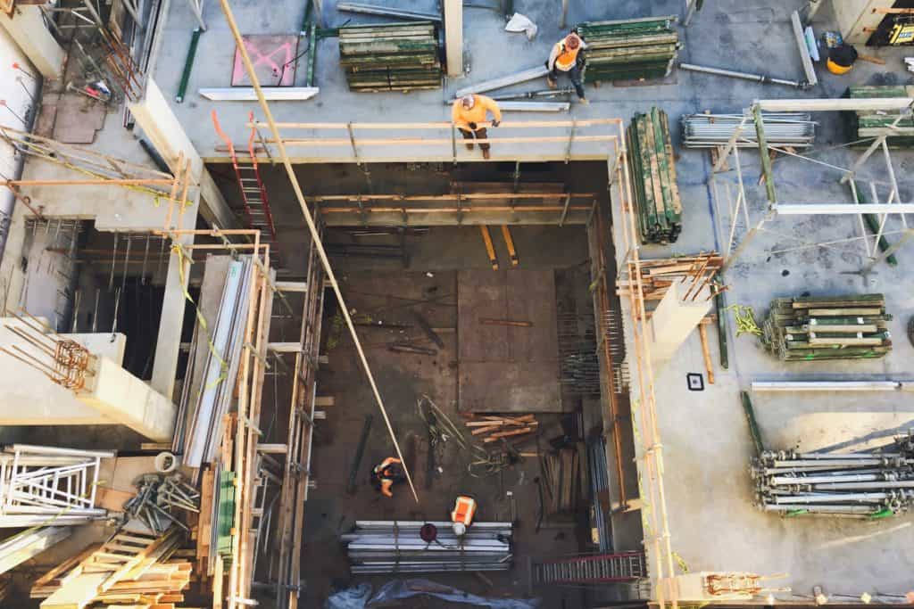
Urban Planning, Architecture and Engineering
- Construction management
- Environmental design
- Mapping
- 3D Modelling
- Marketing
- Site analysis, planning & design
Environmental Management
- Environmental hazard assessment
- Environmental impact assessment & compliance
- Invasive species & pest control
- Scientific research
- Wildlife & habitat monitoring & protection
Media and Communications
- Advertising and marketing
- Photography
- Videography
- Investigative journalism
- Events management
Drone Division Services
Emergency Services and Disaster Recovery
- Disaster & Hazmat monitoring
- Emergency delivery
- Emergency response coordination
- Disaster relief & post-disaster assessment
- Search & rescue
Security Services
- Pipeline inspections and patrols
- Criminal surveillance and tracking
- Police response coordination
- Training and evaluation
- Strike monitoring and reaction
- Perimeter patrols
- Road/railway patrols and protection
Agriculture, Aquaculture, Silviculture & Viticulture
- Chemical & biological monitoring - pesticides & treatments
- Flood & fire detection & monitoring
- Inventory & records
- Pest & disease detection and treatment
- Precision operations and management
Urban Planning, Architecture and Engineering
- Construction management
- Environmental design
- Mapping
- 3D Modelling
- Marketing
- Site analysis, planning & design
Environmental Management
- Environmental hazard assessment
- Environmental impact assessment & compliance
- Invasive species & pest control
- Scientific research
- Wildlife & habitat monitoring & protection
Media and Communications
- Advertising and marketing
- Photography
- Videography
- Investigative journalism
- Events management
Drone Division Fleet
Drone Division Fleet
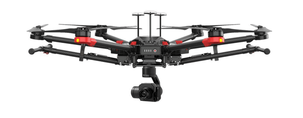
DJI Matrice 600
The DJI Matrice 600 is a 1.6m wide, six motor commercial drone with a flying time of 40 minutes. The M600 is a flying platform designed for professional aerial photography and industrial applications. It is built to closely integrate with a host of powerful technologies, including the A3 flight controller, Lightbridge 2 transmission system, Intelligent Batteries and Battery Management system, for maximum performance and quick setup.
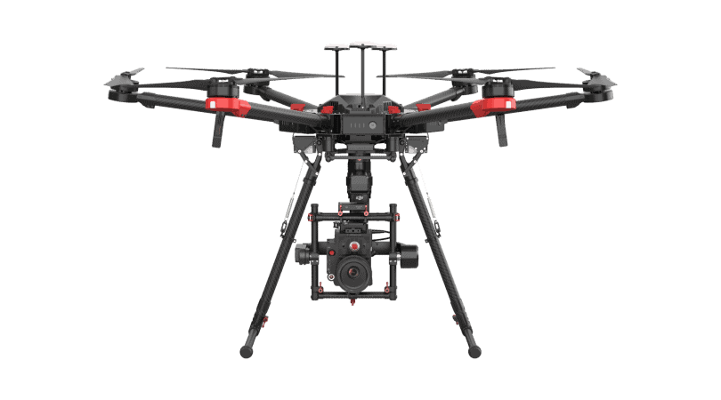
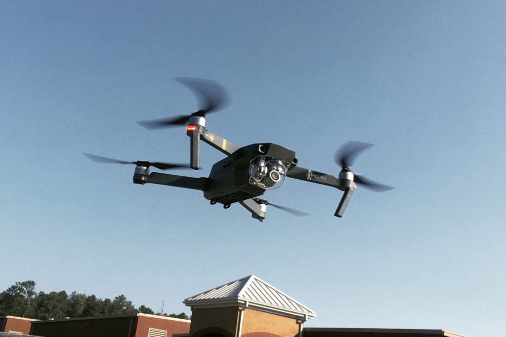
DJI Matrice 600 Pro
The DJI Matrice 600 Pro inherits everything from the M600 with improved flight performance and better loading capacity. Pre-installed arms and antennas reduce time required for setup, and the system’s modular design makes it easy to mount additional modules. Several Zenmuse cameras and gimbals are natively compatible and full integration with third party software and hardware make the M600 Pro ideal for professional industrial applications.
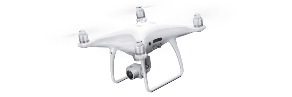
DJI Phantom 4 Pro
The DJI Phantom 4 Pro is a smart prosumer flying camera capable of shooting 4K video at 60fps and up to 100mbps and capturing 20 megapixels stills. Four directions of obstacle avoidance allows it to intelligently avoid obstacles during flight. Using upgraded TapFly and ActiveTrack you can fly anywhere visible on your screen and track a moving subject smoothly and easily though a simple tap. The upgraded camera uses a 1 inch CMOS sensor offering unprecedented clarity, lower noise and better quality images.
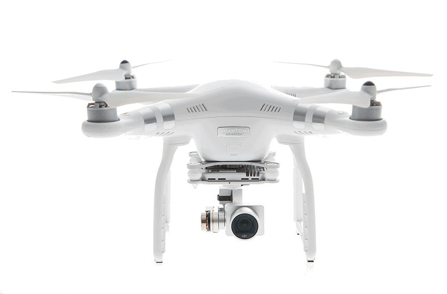
DJI Phantom 3 Advanced
The DJI Phantom 3 Advanced Quadcopter comes with an integrated 2.7K camera and 3-axis gimbal system. It carries a fully stabilised 3-axis 1080p full HD video camera for smooth, crisp videos and still photos.
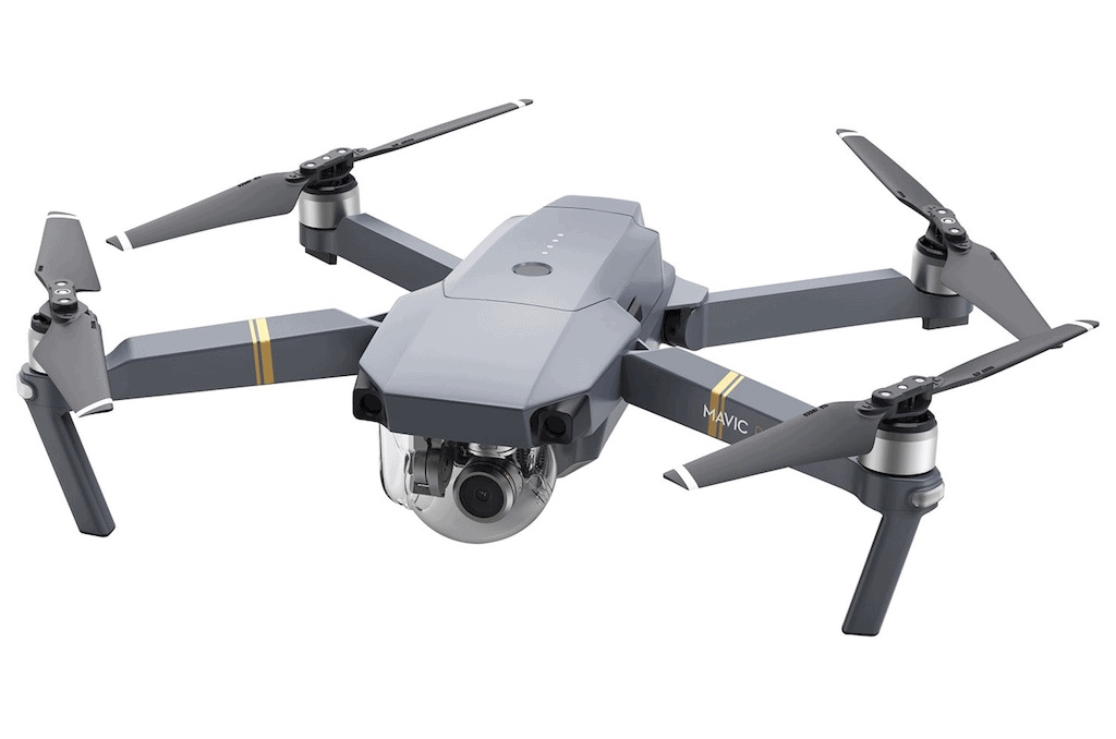
DJI Mavic Pro
Fly at up to 64kmh or for as long as 27-minutes. The DJI Mavic Pro Quadcopter is a small yet powerful drone that turns the sky into your creative canvass easily and without worry, helping you make every moment an aerial moment. 24 high-performance computing cores, an all-new transmission system with a 7Km range, 4 vision sensors, and a 4K camera stabilised by a 3-axis mechanical gimbal, are at your command with just a push of your thumb or a tap of your finger.
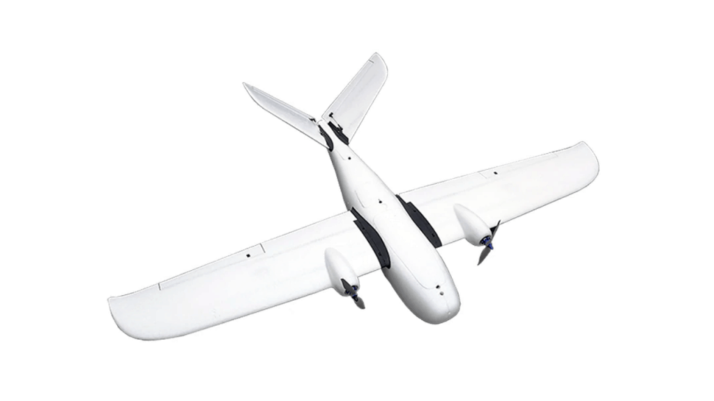
Clouds Fixed Wing
The Clouds Fixed Wing is a 1.8m wing span fixed wing drone with an endurance of around 2 hours. It is perfect for perimeter patrols and quick response applications. With a maximum speed of 15m/s and a wind resistance of 12m/s it can surely get the job done under difficult situations. The operational range is effective up to 80km and the telemetry link can be transmitted to 10km.
Payload Options
Payload Options
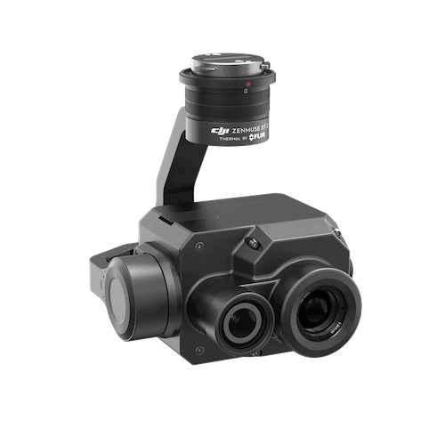
DJI Zenmuse XT2 - Termal Sensor
Join the next generation of commercial drone solutions with the XT2. Pairing the FLIR Tau 2 thermal sensor and 4K visual camera with DJI’s leading stabilization and machine intelligence technology, the XT2 quickly transforms aerial data into powerful insights that save time, money– and lives.
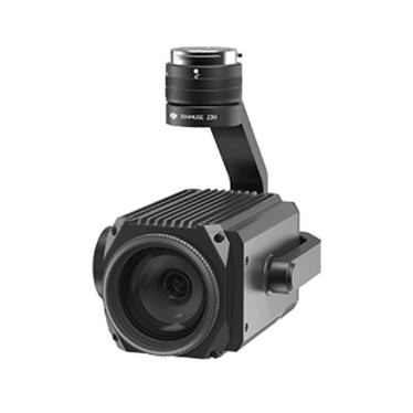
DJI Zenmuse Z30 - Zoom Sensor
Aerial platforms are rapidly becoming vital tools for businesses looking to more efficiently collect information crucial to their operations. As the first integrated aerial camera with an optical zoom up to 30x and digital up to 6x, the Zenmuse Z30 offers unparalleled image data capture. Enterprises are now able to capture the information they require from a greater range, making image data collection significantly faster and eliminates risk of harm to both personnel and equipment.
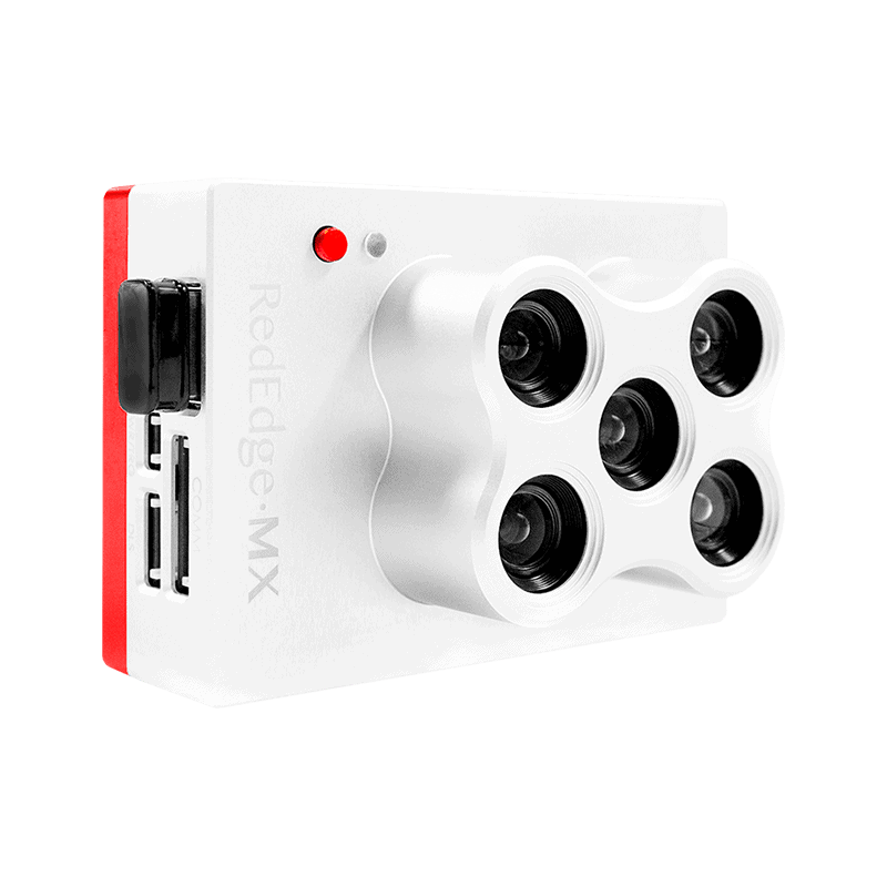
RedEdge-MX - MicaSense
The RedEdge-MX’s low weight, low power requirement, and ability to capture RGB and narrowband spectral bands simultaneously means you can gather the data you need in fewer flights. RedEdge-MX quickly integrates with many different drone platforms. RedEdge-MX has five bands—blue, green, red, red edge, and near-infrared. It simply shows you more. With MicaSense Atlas, you can see many different analytical layers in one easy to use interface, and compare these outputs across time.